
Thurs, Apr 18, 2024 - Santa Monica, CA - Jess Cramp: The Untold Story of Sharks
VENUE: Broadstage, Santa Monica, CA
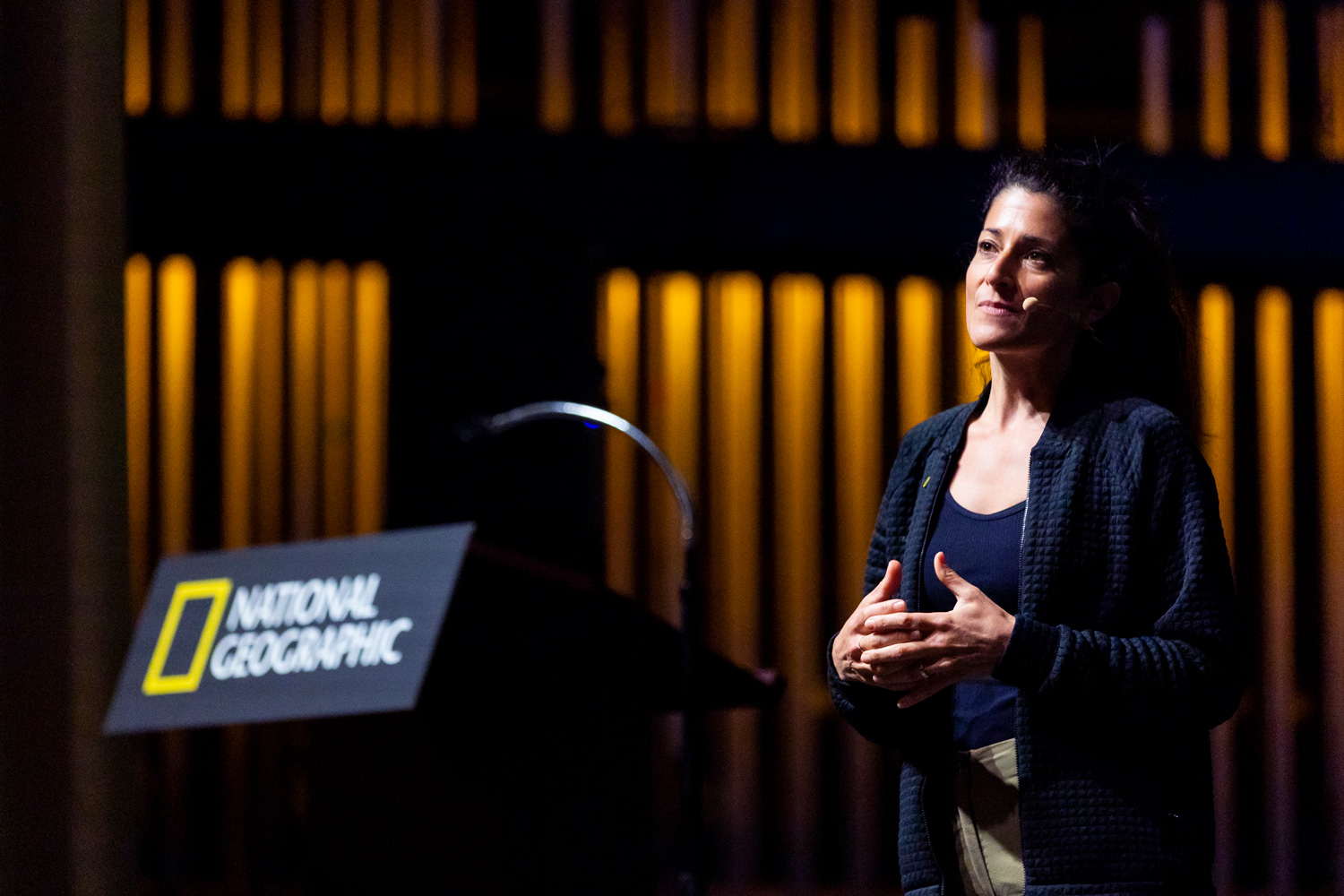
Sharks have roamed the planet’s waters since before the dinosaurs and have evolved into more than a thousand species. But only recently have we begun to understand their lives in the ocean—and how our actions can threaten their survival. Dr. Jess Cramp will take audiences on a journey through the National Geographic archives to discover the work of pioneering women in shark science and storytelling before she dives into her work on the frontier of shark research and conservation. We’ll journey through the vibrant waters of the South Pacific in search of elusive breeding grounds and find out what it truly means to save sharks while working with communities struggling to maintain their traditional ways of life.
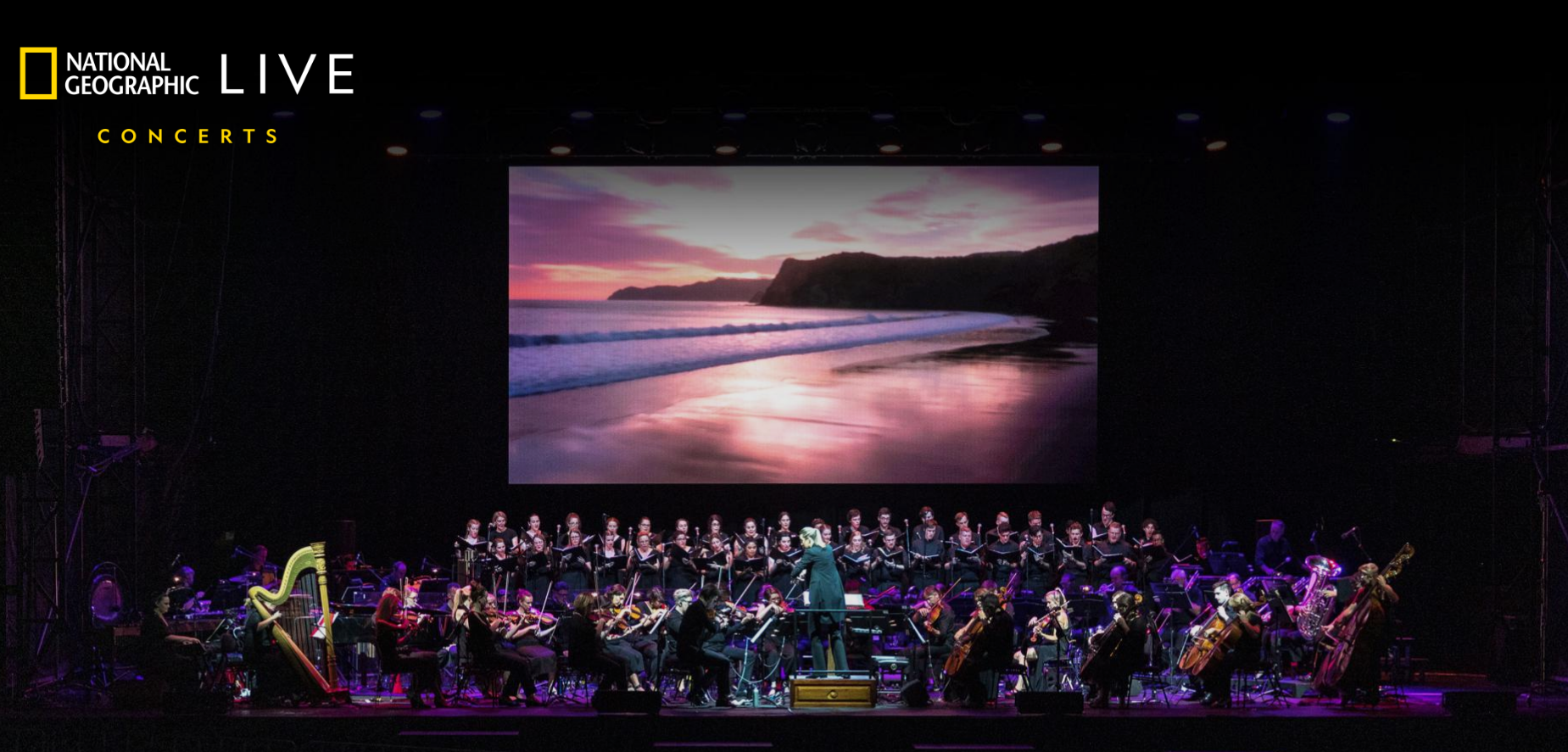
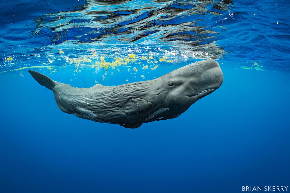
Sun, Apr 21, 2024 - Calgary, AB, Canada - Secrets of the Whales Film Concert
VENUE: Arts Commons Calgary, AB, Canada
From the creative genius of Academy Award-winning filmmaker James Cameron and acclaimed National Geographic Explorer Brian Skerry, the Emmy-winning Disney+ original series Secrets of the Whales takes audiences on an epic journey into the lives of whales, revealing that they are far more like us than ever imagined.
Mon, Apr 22, 2024 - Calgary, AB, Canada - Secrets of the Whales Film Concert
VENUE: Arts Commons Calgary, AB, Canada
From the creative genius of Academy Award-winning filmmaker James Cameron and acclaimed National Geographic Explorer Brian Skerry, the Emmy-winning Disney+ original series Secrets of the Whales takes audiences on an epic journey into the lives of whales, revealing that they are far more like us than ever imagined.
Tues, Apr 23, 2024 - Calgary, AB, Canada - Secrets of the Whales Film Concert
VENUE: Arts Commons Calgary, AB, Canada
From the creative genius of Academy Award-winning filmmaker James Cameron and acclaimed National Geographic Explorer Brian Skerry, the Emmy-winning Disney+ original series Secrets of the Whales takes audiences on an epic journey into the lives of whales, revealing that they are far more like us than ever imagined.
Mon, May 6, 2024 - Toronto, ON, Canada - Jess Cramp: The Untold Story of Sharks
VENUE: Roy Thomson Hall, Toronto, ON Canada
Sharks have roamed the planet’s waters since before the dinosaurs and have evolved into more than a thousand species. But only recently have we begun to understand their lives in the ocean—and how our actions can threaten their survival. Dr. Jess Cramp will take audiences on a journey through the National Geographic archives to discover the work of pioneering women in shark science and storytelling before she dives into her work on the frontier of shark research and conservation. We’ll journey through the vibrant waters of the South Pacific in search of elusive breeding grounds and find out what it truly means to save sharks while working with communities struggling to maintain their traditional ways of life.
Tues, May 7, 2024 - Toronto, ON, Canada - Jess Cramp: The Untold Story of Sharks
VENUE: Roy Thomson Hall, Toronto, ON Canada
Sharks have roamed the planet’s waters since before the dinosaurs and have evolved into more than a thousand species. But only recently have we begun to understand their lives in the ocean—and how our actions can threaten their survival. Dr. Jess Cramp will take audiences on a journey through the National Geographic archives to discover the work of pioneering women in shark science and storytelling before she dives into her work on the frontier of shark research and conservation. We’ll journey through the vibrant waters of the South Pacific in search of elusive breeding grounds and find out what it truly means to save sharks while working with communities struggling to maintain their traditional ways of life.
Sun, May 12, 2024 - Seattle, WA - Jess Cramp: The Untold Story of Sharks
VENUE: Benaroya Hall Seattle, WA
Sharks have roamed the planet’s waters since before the dinosaurs and have evolved into more than a thousand species. But only recently have we begun to understand their lives in the ocean—and how our actions can threaten their survival. Dr. Jess Cramp will take audiences on a journey through the National Geographic archives to discover the work of pioneering women in shark science and storytelling before she dives into her work on the frontier of shark research and conservation. We’ll journey through the vibrant waters of the South Pacific in search of elusive breeding grounds and find out what it truly means to save sharks while working with communities struggling to maintain their traditional ways of life.
Mon, May 13, 2024 - Seattle, WA - Jess Cramp: The Untold Story of Sharks
VENUE: Benaroya Hall Seattle, WA
Sharks have roamed the planet’s waters since before the dinosaurs and have evolved into more than a thousand species. But only recently have we begun to understand their lives in the ocean—and how our actions can threaten their survival. Dr. Jess Cramp will take audiences on a journey through the National Geographic archives to discover the work of pioneering women in shark science and storytelling before she dives into her work on the frontier of shark research and conservation. We’ll journey through the vibrant waters of the South Pacific in search of elusive breeding grounds and find out what it truly means to save sharks while working with communities struggling to maintain their traditional ways of life.
Tues, May 14, 2024 - Seattle, WA - Jess Cramp: The Untold Story of Sharks
VENUE: Benaroya Hall Seattle, WA
Sharks have roamed the planet’s waters since before the dinosaurs and have evolved into more than a thousand species. But only recently have we begun to understand their lives in the ocean—and how our actions can threaten their survival. Dr. Jess Cramp will take audiences on a journey through the National Geographic archives to discover the work of pioneering women in shark science and storytelling before she dives into her work on the frontier of shark research and conservation. We’ll journey through the vibrant waters of the South Pacific in search of elusive breeding grounds and find out what it truly means to save sharks while working with communities struggling to maintain their traditional ways of life.
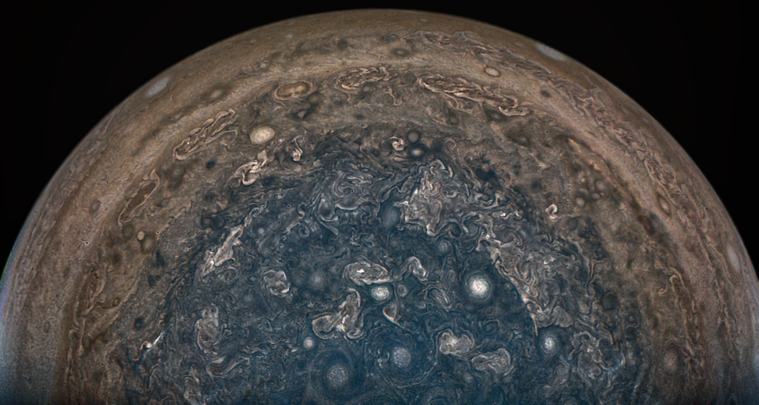
Fri, May 17, 2024 - Dallas, TX - Tracy Drain: Cosmic Adventures
VENUE: The Perot Museum of Nature and Science-Dallas, TX
Discover the marvels of our cosmic backyard through the eyes of the robotic spacecraft sent out to explore it. Aerospace engineer Tracy Drain works at NASA’s Jet Propulsion Laboratory to develop, test, and operate the complex machines that uncover some of the countless mysteries within and beyond our solar system. Join her for thrilling stories of engineering challenges and scientific discoveries from the Kepler mission and its hunt for planets beyond our solar system, a behind-the-scenes account of the Juno mission to Jupiter, and a peek into the Psyche mission to one of the largest objects in the asteroid belt. With infectious enthusiasm, she’ll shine a light on the darkness and vastness of space.
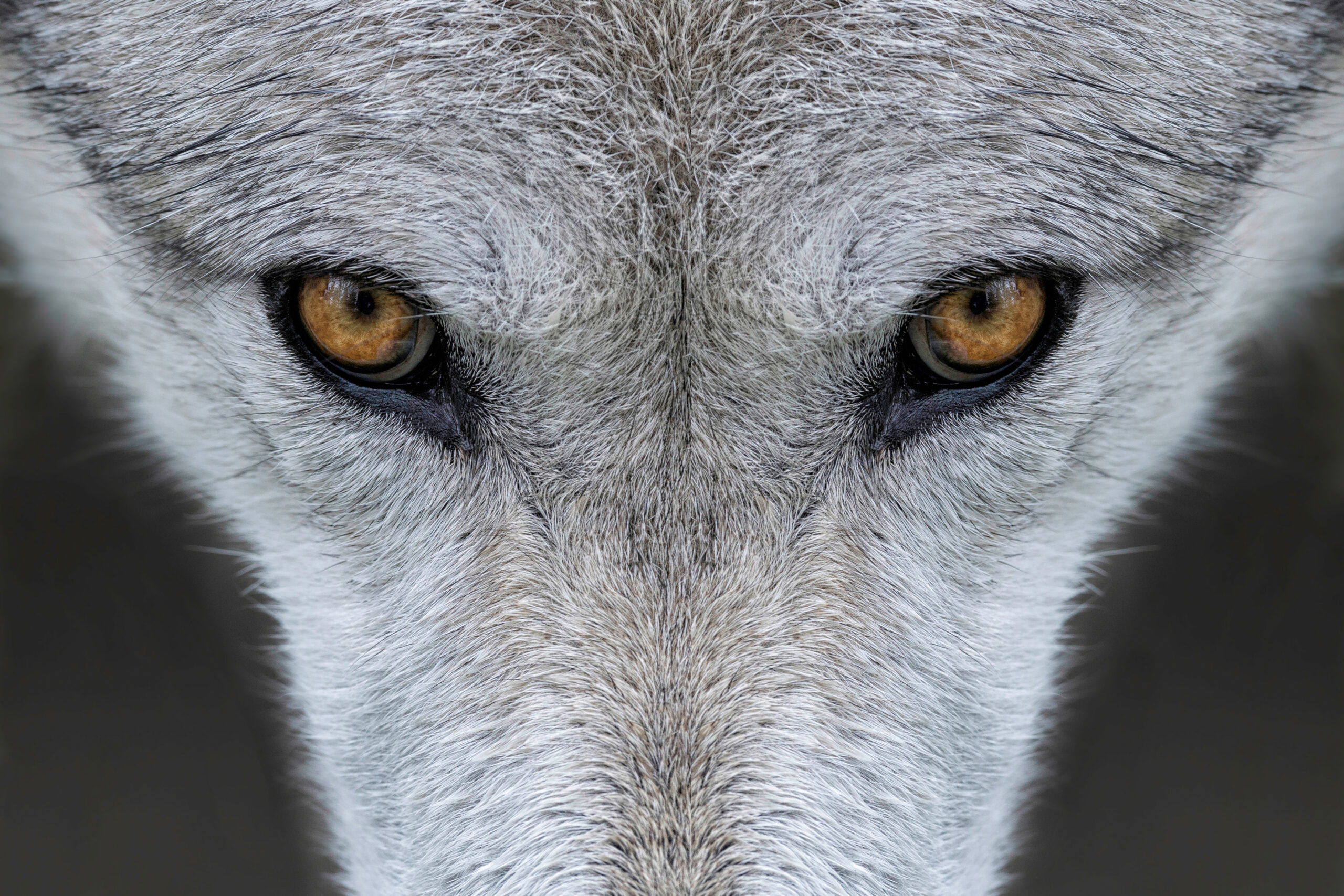
Tues, May 14, 2024 - Buffalo, NY - Doug Smith: Wild Wolves of Yellowstone

VENUE: Kleinhans Music Hall
Yellowstone National Park’s two million acres of wilderness have many stories to tell, from the original native peoples who lived on the land to the epic supervolcano that powers the park’s iconic geysers. But Yellowstone is also a case study in wildlife conservation, from bison to wolves. Now, join Doug Smith on a behind-the-scenes look at the ecosystem and his decades-long quest to reintroduce wolves to the world’s first national park. Return to the wild and witness the beauty, wonder, and science behind America’s greatest wilderness.
Fri, May 24, 2024 - Bellingham, WA - Ronan Donovan: Social by Nature
VENUE: Whatcom Museum – Bellingham, WA
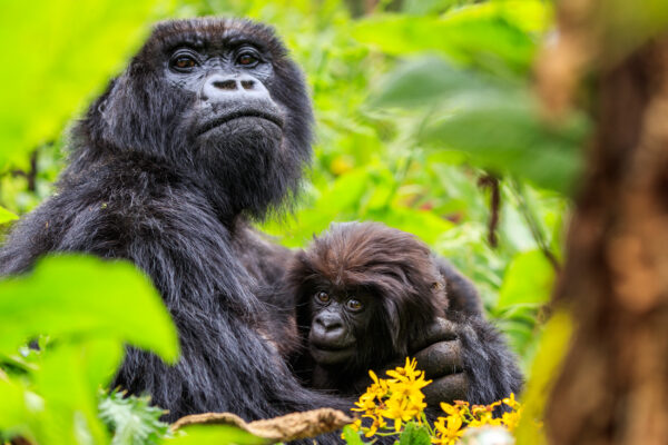
Biologist turned photographer Ronan Donovan delves into the essence of what it means to be human by exploring our kinship with social mammals. Humans at our core are social mammals. We build relationships, communicate, reproduce, establish territories and adapt to shrinking resources. In these ways–and others– we’re no different than chimpanzees, wolves, gorillas and bears, who are among the most charismatic of the social mammals we know. We identify with them as species, groups, and even as named individuals. They’re also under threat. Join Donovan as he talks about his work in documenting these animals and what we, as fellow social mammals, can learn from them.
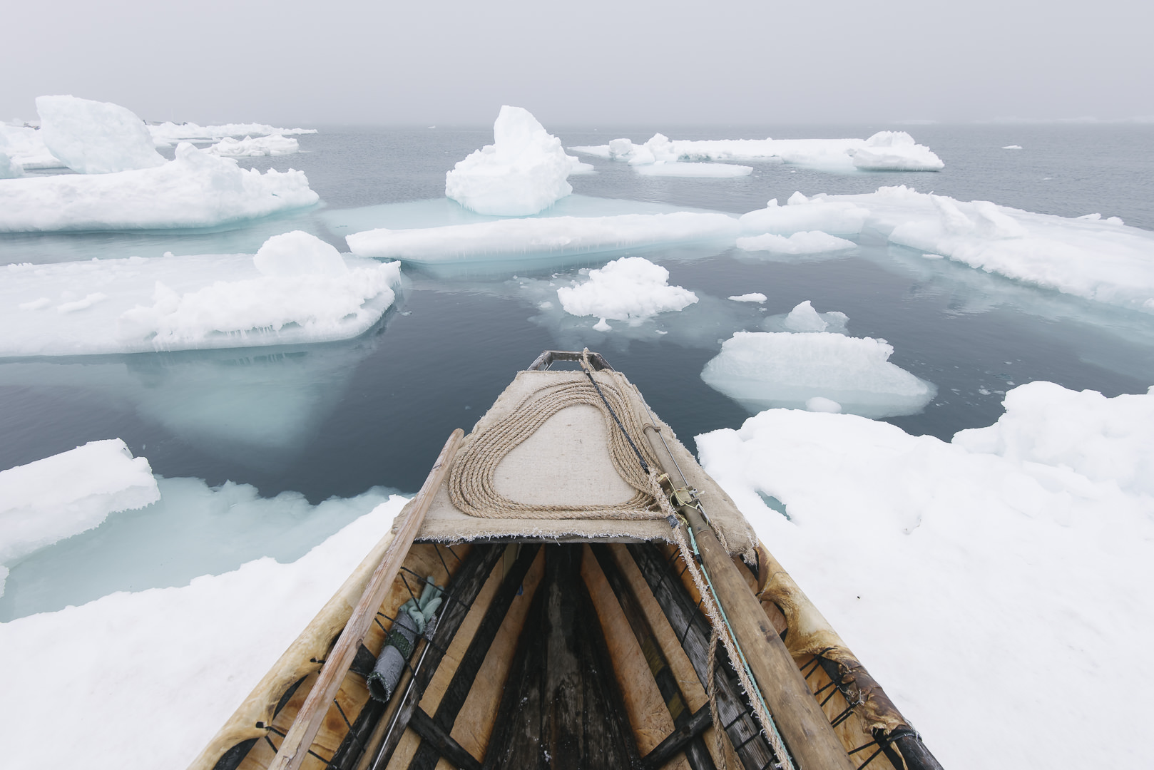
Sun, May 26, 2024 - Calgary, AB, Canada - Kiliii Yuyan: Life on Thin Ice
VENUE: Arts Commons Calgary, AB, Canada
In the Arctic north, sea ice is synonymous with the sand in the desert. The ice is vital for transportation, for food, for living. And while the temperatures seem inhumane, the Arctic is teeming with life. Indigenous tribes call this frosty land home, but they’re not alone. Polar bears, musk ox, whales and caribou are some of the Arctic animals co-existing with more than 40 different ethnic groups in the north. Through beautiful images and awe-inspiring moments, National Geographic Live takes you on a journey with our first Indigenous speaker Kiliii Yüyan to understand the native peoples and their relationship to a frigid land and its animals.
Mon, May 27, 2024 - Calgary, AB, Canada - Kiliii Yuyan: Life on Thin Ice
VENUE: Arts Commons Calgary, AB, Canada
In the Arctic north, sea ice is synonymous with the sand in the desert. The ice is vital for transportation, for food, for living. And while the temperatures seem inhumane, the Arctic is teeming with life. Indigenous tribes call this frosty land home, but they’re not alone. Polar bears, musk ox, whales and caribou are some of the Arctic animals co-existing with more than 40 different ethnic groups in the north. Through beautiful images and awe-inspiring moments, National Geographic Live takes you on a journey with our first Indigenous speaker Kiliii Yüyan to understand the native peoples and their relationship to a frigid land and its animals.
Sun, Jun 2, 2024 - Toronto, ON, Canada - Kiliii Yuyan: Life on Thin Ice
VENUE: Roy Thomson Hall, Toronto, ON
In the Arctic north, sea ice is synonymous with the sand in the desert. The ice is vital for transportation, for food, for living. And while the temperatures seem inhumane, the Arctic is teeming with life. Indigenous tribes call this frosty land home, but they’re not alone. Polar bears, musk ox, whales and caribou are some of the Arctic animals co-existing with more than 40 different ethnic groups in the north. Through beautiful images and awe-inspiring moments, National Geographic Live takes you on a journey with our first Indigenous speaker Kiliii Yüyan to understand the native peoples and their relationship to a frigid land and its animals.
Mon, Jun 3, 2024 - Toronto, ON, Canada - Kiliii Yuyan: Life on Thin Ice
VENUE: Roy Thomson Hall, Toronto, ON
In the Arctic north, sea ice is synonymous with the sand in the desert. The ice is vital for transportation, for food, for living. And while the temperatures seem inhumane, the Arctic is teeming with life. Indigenous tribes call this frosty land home, but they’re not alone. Polar bears, musk ox, whales and caribou are some of the Arctic animals co-existing with more than 40 different ethnic groups in the north. Through beautiful images and awe-inspiring moments, National Geographic Live takes you on a journey with our first Indigenous speaker Kiliii Yüyan to understand the native peoples and their relationship to a frigid land and its animals.
Tues, Jun 4, 2024 - Toronto, ON, Canada - Kiliii Yuyan: Life on Thin Ice
VENUE: Roy Thomson Hall, Toronto, ON
In the Arctic north, sea ice is synonymous with the sand in the desert. The ice is vital for transportation, for food, for living. And while the temperatures seem inhumane, the Arctic is teeming with life. Indigenous tribes call this frosty land home, but they’re not alone. Polar bears, musk ox, whales and caribou are some of the Arctic animals co-existing with more than 40 different ethnic groups in the north. Through beautiful images and awe-inspiring moments, National Geographic Live takes you on a journey with our first Indigenous speaker Kiliii Yüyan to understand the native peoples and their relationship to a frigid land and its animals.
Fri, Jun 14, 2024 - Las Vegas, NV - Doug Smith: Wild Wolves of Yellowstone
VENUE: The Smith Center, Las Vegas, NV
Yellowstone National Park’s two million acres of wilderness have many stories to tell, from the original native peoples who lived on the land to the epic supervolcano that powers the park’s iconic geysers. But Yellowstone is also a case study in wildlife conservation, from bison to wolves. Now, join Doug Smith on a behind-the-scenes look at the ecosystem and his decades-long quest to reintroduce wolves to the world’s first national park. Return to the wild and witness the beauty, wonder, and science behind America’s greatest wilderness.
Sun, Jun 23, 2024 - Seattle, WA - Doug Smith: Wild Wolves of Yellowstone
VENUE: Benaroya Hall Seattle, WA
Yellowstone National Park’s two million acres of wilderness have many stories to tell, from the original native peoples who lived on the land to the epic supervolcano that powers the park’s iconic geysers. But Yellowstone is also a case study in wildlife conservation, from bison to wolves. Now, join Doug Smith on a behind-the-scenes look at the ecosystem and his decades-long quest to reintroduce wolves to the world’s first national park. Return to the wild and witness the beauty, wonder, and science behind America’s greatest wilderness.
Mon, Jun 24, 2024 - Seattle, WA - Doug Smith: Wild Wolves of Yellowstone
VENUE: Benaroya Hall Seattle, WA
Yellowstone National Park’s two million acres of wilderness have many stories to tell, from the original native peoples who lived on the land to the epic supervolcano that powers the park’s iconic geysers. But Yellowstone is also a case study in wildlife conservation, from bison to wolves. Now, join Doug Smith on a behind-the-scenes look at the ecosystem and his decades-long quest to reintroduce wolves to the world’s first national park. Return to the wild and witness the beauty, wonder, and science behind America’s greatest wilderness.
Tues, Jun 25, 2024 - Seattle, WA - Doug Smith: Wild Wolves of Yellowstone
VENUE: Benaroya Hall Seattle, WA
Yellowstone National Park’s two million acres of wilderness have many stories to tell, from the original native peoples who lived on the land to the epic supervolcano that powers the park’s iconic geysers. But Yellowstone is also a case study in wildlife conservation, from bison to wolves. Now, join Doug Smith on a behind-the-scenes look at the ecosystem and his decades-long quest to reintroduce wolves to the world’s first national park. Return to the wild and witness the beauty, wonder, and science behind America’s greatest wilderness.
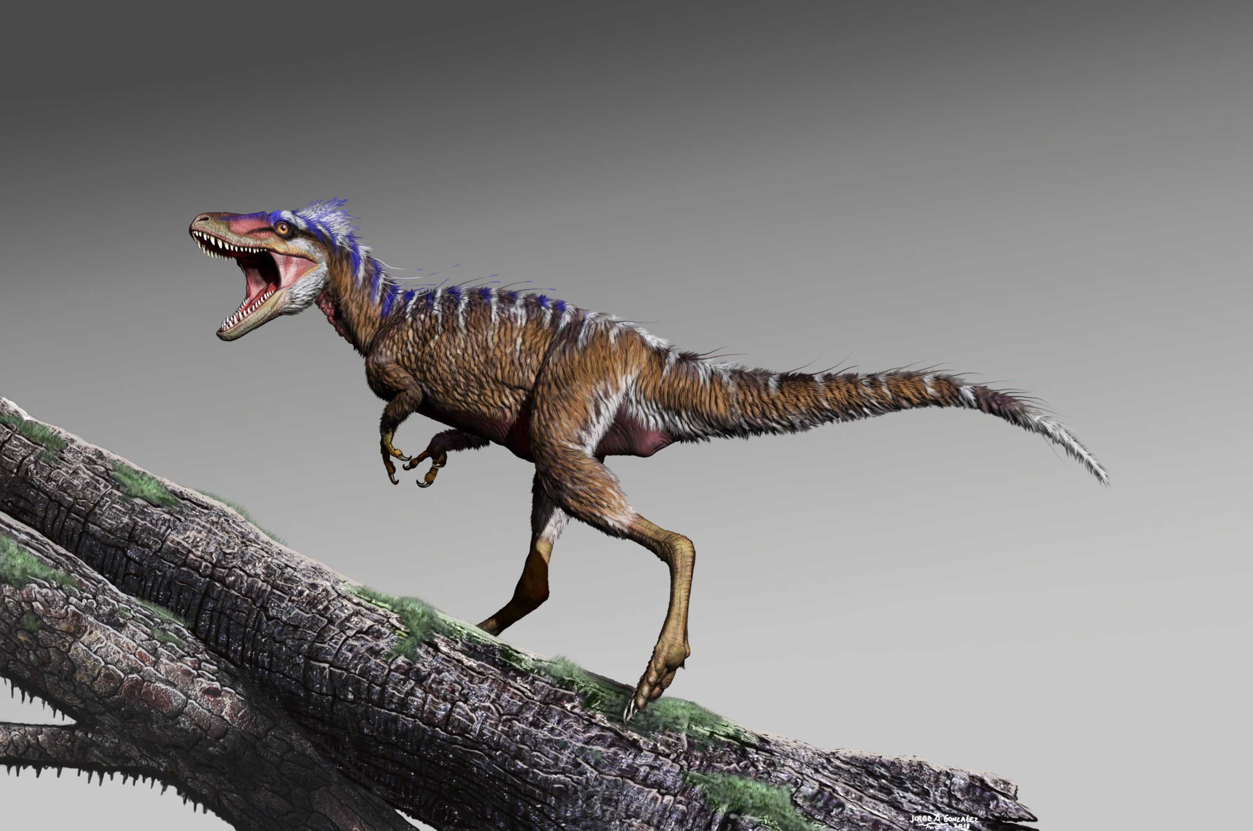
Wed, Oct 2, 2024 - Dallas, TX - Lindsay Zanno: Rise of T. rex
VENUE: The Perot Museum of Art – Dallas, TX
How did T. rex become the iconic apex predator of North America 66 million years ago? Paleontologist Dr. Lindsay Zanno is uncovering the answer. Each year she spends several months on expedition, scouring the badlands of western North America in search of clues. Along the way, she has discovered many new species—including some of the earliest predecessors of T. rex. Join Lindsay for a fascinating look at how a global climate crisis during the Cretaceous changed the course of evolution for this prehistoric tyrant and its ancestors.